



Equipment Geofencing Software for Construction Job Sites
A geofence is a boundary drawn around a job site, yard, or dispatch area that records when a machine enters or leaves. Clue uses geofences to confirm arrivals, send entry and exit alerts, and flag after-hours movement.







Asset geofencing
Draw the line once. Know every time it is crossed.

Custom Geofence Zones for Jobsites and Yards
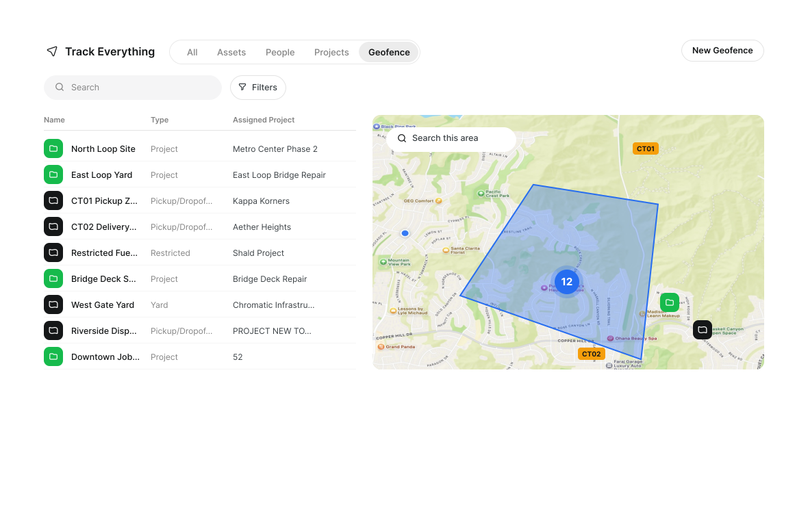
Teams draw reusable geofences around jobsites, yards, staging areas, and restricted areas for alerts, dispatch, and timecard review.
Custom shape drawing: Draw polygon or circle geofences around jobsites, yards, staging areas, and restricted zones
Bulk KML/KMZ import: Clue uses one KML or KMZ upload to create many geofences from existing site boundaries.
Project and team assignment: Assign geofences to projects or business units for cleaner filtering and reporting
Track Everything map: View geofences alongside equipment activity from Clue’s live map

Jobsite Perimeter Alerts for Equipment Movement
Clue sends equipment geofence alerts when equipment enters or exits a jobsite. Teams use each alert to confirm arrivals, flag exits, and review after-hours movement.
Arrival alerts: Notify teams when equipment enters a selected geofenced zone
Departure alerts: Flag when equipment exits a jobsite, yard, or restricted-area boundary
Alert setup: Each geofence has its own alerts for entry, exit, or both. Each alert covers selected equipment. Clue sends it to chosen people or crews.

Dispatch Region Geofencing for Multi-Site Coordination
Create mapped pickup, dropoff, yard, and delivery zones that dispatch teams can use when planning equipment moves across active sites.
Dispatch region geofences: Define saved zones for jobsites, yards, pickup points, and delivery areas
Snap adjacent boundaries: Align neighboring geofence edges for cleaner dispatch region coverage
Pickup and dropoff zones: Use saved geofences when planning where equipment needs to move
Dispatch arrival visibility: Review arrival activity when equipment reaches a linked destination geofence

After-Hours Movement and Theft Response Alerts
Unexpected equipment movement after hours needs fast review. Geofence alerts help teams see when equipment exits a site boundary, moves outside configured operating windows, or enters a restricted-area geofence.
After-hours movement alerts: Surface movement outside configured operating windows
Unexpected departure alerts: Notify teams when equipment exits a defined boundary after hours
Movement history: Review recorded location activity after a geofence event
Location sharing follow-up: Share a live equipment location link when a faster response is needed

Destination Geofence Arrival Alerts
Dispatchers use saved geofences as pickup and dropoff points. When equipment enters its destination zone, Clue logs the arrival and sends an alert. Dispatchers see the arrival on the live map. Teams make fewer check-in calls.
Dispatch location support: Use saved geofences or map pins when setting pickup and dropoff locations
Delivery status review: Help dispatchers check whether equipment reached the expected site or zone
Driver confirmation: The driver confirms the drop-off in the Clue app. This marks the delivery as delivered. Clue sends an "Assets delivered" notification.

Geofence Activity Records in Track Everything
After a boundary alert, managers need a clear way to review the event. Track Everything keeps geofence activity visible with asset location, zone details, and recorded entry or exit activity in one live map view.
Geofence activity log: Review entry, exit, and alert activity tied to assets and zones
Search and filtering: Find geofence activity by asset, zone, or date where available
Movement review: Use recorded activity to support internal follow-up after a geofence alert
Built for every role
Solutions for every team.
Field, shop, and office teams use the same system. Equipment managers, fleet managers, operations leaders, CFOs, and executives see equipment details for their work.

Equipment Manager
“It's a single pane of glass where you see everything across your fleet, from the field to the phone to the computer.”
Abe Sharaf
Equipment Manager, Pulice Construction
Read Pulice’s story

Fleet Manager
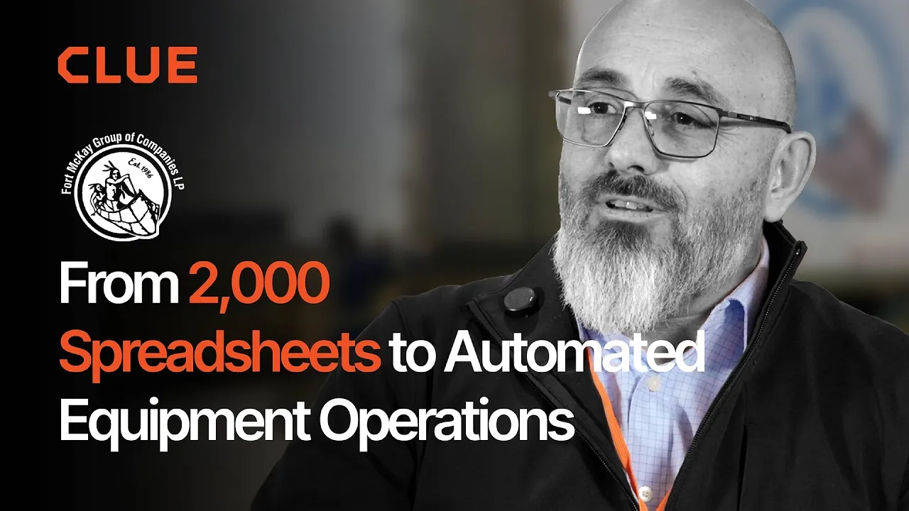
“Imagine receiving 2,000 spreadsheets that needed to be approved individually in an email. There were entire teams dedicated to that. Now the system is fully automated, completely automated from beginning to end.”
Julio Lopez
Fleet Manager, Fort McKay Group
Read Fort McKay’s story

CFO
“You went from doing two services a day to six services a day. That right there is priceless to me.”
Darrin Sheriff
Director of Maintenance & Purchasing, Palmetto Corp
Read Palmetto’s story

VP of Operations
“The big thing with Clue is that we're able to bridge the gap between our field, our operators in our shop, and other departments. Everybody's bought into Clue now.”
Eric Sellman
COO, Brent Scarbrough & Co
Read Brent Scarbrough’s story

Executive
“We had 20 different logins between all our different softwares and web platforms. Now all that information pulls into one spot and we're able to see it in a single place.”
John Igel
CEO, George Igel Co.
Read Igel’s story

Operations Manager
“The operator's in control of his own destiny. That was a huge reason why not only did I buy into it, but I'm also investing into it for the future.”
Ben Benoit
Operations Manager, Onshore Companies
Read Onshore’s story
Across every boundary
Why Construction Companies Use Clue Geofencing
Geofencing helps equipment teams protect high-value assets, spend less time on manual follow-up, and keep better control of where equipment moves.
Respond Faster to Theft
After-hours movement and unexpected boundary alerts help teams respond faster when equipment leaves a jobsite, yard, or restricted zone.
Confirm Arrivals Faster
Arrival alerts and the arrival log show dispatchers when equipment reaches its destination geofence.
Speed Up Jobsite Setup
One KML or KMZ upload creates many jobsite geofences at once.
Catch Off-Site Hours Early
Geofence-based timecard flags help supervisors review labor entries logged outside expected jobsite boundaries before approval.
See Equipment in Each Zone
Geofences show which equipment sits inside each jobsite, yard, staging area, or dispatch zone. Clue logs every entry and exit.
Improve Movement Accountability
Track Everything gives teams a record of geofence activity so boundary crossings can be reviewed by asset, zone, and date.
Geofences Use Fleet Location Data
Geofences use location data from OEM telematics, GPS, and aftermarket trackers. Clue's 80+ integrations include ERP, accounting, and CMMS systems. Teams add equipment by hand to the same fleet view.
















































From the people who use it every day
What contractors say
“Our field guys were tired of having a new product, a new something to learn each time.”
Rob Judge, Sr. Procurement & Program Manager
“The big thing with Clue is that we’re able to bridge the gap between our field, our operators in our shop, and other departments.”
Brent Scarbrough & Company
“There were entire teams dedicated to approving spreadsheets one by one.”
Fort McKay First Nation
“The biggest difference has been the user friendliness.”
William A. Hazel
“It exposes dead cost or overhead that maybe we don’t know about because it gets lost in those three different systems.”
Moss Utilities
“Clue’s real-time data capability has completely changed the way we manage our assets.”
Darrin Sheriff, Director of Maintenance and Purchasing
“It was probably taking the better part of a day to combine all the data from the telematics.”
Derek Wolfe, Equipment Manager, George Igel Co.
“Clue allows us to effectively control our operations: financially, effectively and safely.”
Joseph Yammine, Project Manager, Graham
“QR codes have been a game changer for us with regards to operator inspections.”
Ben Benoit, Operations Manager
“It’s a single pane of glass where you see everything across your fleet, from the field to the phone to the computer.”
Abe Sharaf, Corporate Equipment Engineer
“Our equipment is in far better shape since we started using Clue, for sure.”
Jake Farley, Equipment Manager, Silver Star Construction













Asset Directory in Clue: Saved Views, Bulk Edits & Meters
Parts Management in Clue: Requests, Delivery Tracking & Inventory
Template Manager in Clue: Inspection Templates, AI Import & Shared Categories
Preventive Maintenance in Clue: Build a PM Plan, Automate Work Orders
Work Orders in Clue: Repair History, Parts, and Labor Costs
Common questions
Construction geofencing software FAQ.
What is construction geofencing software?
Construction geofencing software helps equipment teams create virtual boundaries around jobsites, yards, staging areas, dispatch zones, and restricted areas. When GPS-tracked equipment enters or exits a boundary, teams can receive alerts, review movement activity, and use those events in dispatch, timecard, and fleet workflows.
Can I import geofences from KML or KMZ files?
Yes. Teams upload an existing map or GIS file in KML or KMZ format. Clue creates many jobsite geofences at once. One upload helps contractors set up sites, yards, and project areas.
Can geofences be linked to projects or teams?
Yes. Teams assign each geofence to a project or business unit. They filter geofence activity and reports by project or business unit.
Does geofencing work with all GPS and telematics providers?
Geofencing works for any equipment that reports a location to Clue. Clue supports heavy equipment geofence tracking through 80+ integrations. These include John Deere, Caterpillar (VisionLink), Komatsu (Komtrax), Volvo, and Hitachi telematics, plus GPS trackers, aftermarket trackers, and AEMP 2.0 feeds. Update rates vary by provider. The team checks each feed during setup.
Can I set different alerts for arrivals, departures, and after-hours movement?
Yes. Each geofence has entry, exit, or both alerts. Separate time windows cover weekdays, weekends, and holidays at any time or set hours. Clue sends fired alerts to chosen people or crews. The notification feed lists each alert.
Can geofences help review timecards?
Yes. Clue flags a timecard that lists hours outside the jobsite geofence. The entry goes through. A manager reviews the flag before approval.
Can geofences be used to confirm equipment deliveries?
Saved geofences set pickup and drop-off points. An alert fires when equipment enters the destination geofence. The driver confirms the drop-off in the Clue app. This marks the delivery as delivered. Clue sends an "Assets delivered" notification.
How is Clue different from GPS-only geofence tools?
Clue ties each geofence to equipment records, dispatch pickup and dropoff points, timecard flags, and projects. Entry and exit events appear on the live map with the equipment record.
How does geofencing help with construction equipment theft?
Geofencing helps teams spot equipment movement and respond after an alert. Clue sends the alert when equipment leaves a jobsite, yard, or restricted zone. Teams review its movement history after the alert. They can share a live location link for the equipment with anyone.
Does dispatch need a geofence to send equipment to a location?
Dispatch can send equipment to any map pin or street address. Drivers and dispatchers drop a pin on the map or enter an address for a pickup or dropoff at a new site. Saved geofences work as pickup and dropoff points.
Do Clue geofences work with Vista?
Clue geofences work with Vista for companies that use Viewpoint EMLM. Projects sync from Vista into Clue. Clue creates a geofence record for each project. Each record feeds equipment location data into Vista, linking the project from Vista with the equipment location data from Clue.
How can I track equipment in a yard with a geofence?
A yard geofence lets teams track which equipment sits inside the yard. Teams draw the zone around the yard. Clue logs each entry and exit. The live map shows the equipment inside the yard. When equipment exits the zone, Clue sends an alert.